
Reading the Deccan Plateau
Reference library · 971 words

Most of peninsular India is not plain but plateau. South of the Narmada river the land rises into a broad, tilted tableland known as the Deccan, from the Sanskrit dakshina, meaning south. It is roughly triangular, bounded on the west by the Western Ghats, on the east by the lower and broken Eastern Ghats, and on the north by the Satpura and Vindhya ranges with the rift valleys of the Narmada and Tapi between them. Its surface lies mostly between three hundred and nine hundred metres above sea level. Almost everything distinctive about the region, its soils, its rivers, its rainfall, its crops and a good deal of its history, follows from that geometry.
A continent that bled basalt
The northern and western Deccan is floored by one of the largest volcanic provinces on earth. Around sixty six million years ago, as the Indian plate drifted north across the volcanic hotspot now sitting beneath Reunion island, fissures opened and lava flooded out in sheets rather than from cone shaped volcanoes. The resulting Deccan Traps still cover something on the order of five hundred thousand square kilometres and reach more than two kilometres in thickness near the Western Ghats escarpment. The word trap comes from the Swedish for stair, and describes the step like profile of the weathered flows, visible in the hillsides above Pune and in the plateaux around Mahabaleshwar.
The timing places the eruptions close to the extinction event that ended the age of the dinosaurs, and this has produced one of the long running disputes in earth science. One camp holds that the asteroid impact recorded at Chicxulub in Mexico was the decisive cause; another argues that Deccan volcanism, with its sustained release of sulphur dioxide and carbon dioxide, had already destabilised the climate. Recent work tends toward a combination, with the impact possibly intensifying eruption rates. The dispute is real and unresolved, and the Deccan escarpments are among the main pieces of physical evidence in it.
Southward and eastward the geology changes completely. Around Hyderabad and across much of Karnataka the plateau is built on the Dharwar craton, ancient granites and greenstones some of the oldest rocks on the planet, which weather into the rounded boulder fields that give Hampi and the Hyderabad outskirts their peculiar look. The diamond bearing gravels once worked near Golconda, which produced some of the most famous stones in the world, come from this older terrain rather than from the basalt.
Tilt, rain shadow and black soil
The plateau is tilted so that its western edge stands high and its surface slopes gently east. That is why the great peninsular rivers, the Godavari, Krishna, Bhima and Kaveri, rise within a hundred kilometres or so of the Arabian Sea and then run several hundred kilometres in the opposite direction to reach the Bay of Bengal. Rivers flowing west are short, steep and often end in estuaries along the Konkan and Malabar coasts.
The same escarpment produces a rain shadow. When the south west monsoon arrives in June it is forced upward by the Western Ghats, dumps very heavy rain on the coastal side and on the crest, and descends drier onto the interior. The contrast is severe: parts of the Ghats receive several thousand millimetres a year while the interior of Marathwada and the Rayalaseema districts of Andhra Pradesh may receive only six or seven hundred, and in a bad year far less. The interior Deccan is therefore semi-arid and prone to recurring drought, a fact that has shaped its agriculture, its migration patterns and its politics.
Weathering of the basalt has produced regur, the black cotton soil, dark, clayey and highly retentive of moisture. It swells when wet and cracks deeply when dry. Where rainfall is unreliable that moisture holding capacity is precious, and it made the Deccan a cotton growing region long before the American Civil War cut off supplies to Lancashire mills and sent Bombay's cotton trade into a boom. The same basalt, however, is a poor aquifer. Hard rock holds water only in fractures and in weathered upper zones, so borewells in the Deccan are shallow, unpredictable and quick to fail. This is the physical reason that groundwater depletion and tanker supplied villages are a recurring summer story across Maharashtra and interior Karnataka, and why the spread of sugarcane, an extraordinarily thirsty crop, into semi-arid districts is so bitterly argued about.
The plateau as a historical arena
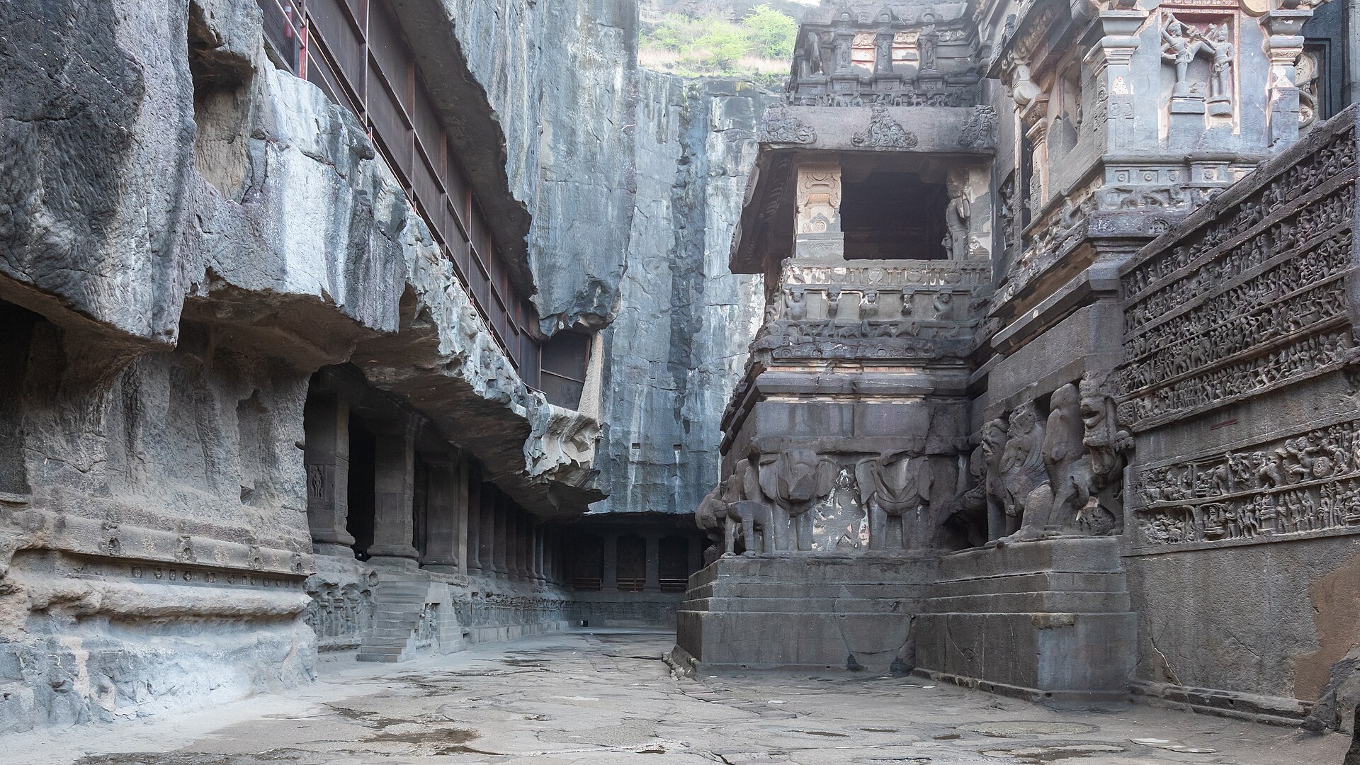
Because the Deccan sits between the Gangetic north and the Tamil south, it has been a zone of contest rather than a periphery. The Satavahanas ruled it in the early centuries of the common era; the Chalukyas of Badami, the Rashtrakutas and the Yadavas followed. The Rashtrakutas left the Kailasa temple at Ellora, carved downward out of a single basalt hillside in the eighth century, which is only possible because of the layered lava flows. From the fourteenth century the plateau was divided between the Vijayanagara empire in the south, with its capital at Hampi on the Tungabhadra, and the Bahmani sultanate in the north, which fragmented into the sultanates of Bijapur, Golconda, Ahmadnagar, Bidar and Berar. A coalition of those sultanates defeated Vijayanagara at Talikota in 1565 and Hampi was sacked. Mughal armies under Aurangzeb spent the last decades of the seventeenth century trying to absorb the Deccan and were exhausted by Maratha resistance in its hills. The Nizams of Hyderabad, successors to a Mughal viceroyalty, ruled a large part of it until 1948.
That layered history is also why the plateau is a linguistic crossroads. Marathi, Telugu and Kannada meet across it, with Urdu long established in the old sultanate towns. A traveller crossing from Solapur to Kalaburagi to Hyderabad passes through three literary traditions in a few hundred kilometres, over the same black soil and the same stepped basalt hills.
References
- Encyclopaedia BritannicaDeccan Plateau
- Encyclopaedia BritannicaDeccan Traps
- Geological Survey of IndiaGeology of India
- UNESCO World Heritage CentreGroup of Monuments at Hampi
- UNESCO World Heritage CentreEllora Caves
This is a reference article, written from the sources above. It is background, not news reporting.